Customize Consent Preferences

We use cookies to help you navigate efficiently and perform certain functions. You will find detailed information about all cookies under each consent category below.

The cookies that are categorized as "Necessary" are stored on your browser as they are essential for enabling the basic functionalities of the site. ... 

Always Active

Necessary cookies are required to enable the basic features of this site, such as providing secure log-in or adjusting your consent preferences. These cookies do not store any personally identifiable data.

No cookies to display.

Functional cookies help perform certain functionalities like sharing the content of the website on social media platforms, collecting feedback, and other third-party features.

No cookies to display.

Analytical cookies are used to understand how visitors interact with the website. These cookies help provide information on metrics such as the number of visitors, bounce rate, traffic source, etc.

No cookies to display.

Performance cookies are used to understand and analyze the key performance indexes of the website which helps in delivering a better user experience for the visitors.

No cookies to display.

Advertisement cookies are used to provide visitors with customized advertisements based on the pages you visited previously and to analyze the effectiveness of the ad campaigns.

No cookies to display.

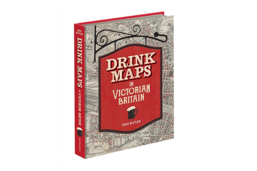
A book exploring the history of drinking in Victorian Britain via ‘drink maps’ created by the temperance movement has been published by the Bodleian Library.

Drink Maps

“This is the story of drink maps, and it’s probably not what you think. It’s not about pub crawls or plotted ale trails,” said author Kris Butler.

“Instead these are maps with an agenda that was adamantly hostile to drinking alcohol, made by an organised faction known as the temperance movement. The logic at the time of the maps’ creation went as follows: if people are shown how many places there are to buy alcohol, they will be so appalled that they will join the effort to end drinking. In hindsight this logic is obviously flawed.”

Drink Maps in Victorian Britain explores how drink maps of cities were published to fight increasingly rampant alcohol consumption, from Liverpool, Manchester, and Sheffield to Oxford, London, and Norwich.

Kris Butler is also a lawyer, past president of the Boston Map Society, and currently serves on the board of the Washington Map Society.  She is also an award-winning home brewer and a contributor to MAP: Exploring the World, published by Phaidon. She has done numerous talks about drink maps in the US and also at the International Conference of the History of Cartography in Amsterdam.

Drink Maps in Victorian Britain is published by Bodleian Libraries at £25.